- Discover
- Walking The Pyrenean High Route
Walking the Pyrenean High Route
-
The unfamiliar terrain and length of the HRP meant it was impossible to properly imagine what we were about to do. That is the essence of true adventure.
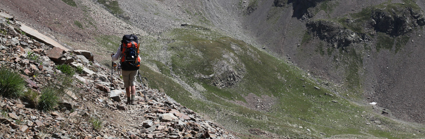
The Pyrenees mountain range spans the entire 420 kilometre length of the Atlantic to Mediterranean border between France and Spain. Culturally diverse and spectacular, this region of endless walking opportunities is more wild and remote than the main European Alps. I have said often enough that I could spend the rest of my life walking in the Pyrenees. After a lifetime of doing the hard trips in places like SW Tasmania, New Zealand, the Kimberley, elsewhere in remote Australia and many other parts of the world, it is the high Pyrenees that combine similar physical and mental challenges - and in stunning surroundings - just without the need for 25 or more kilograms in the pack. Most people associate walking in the Pyrenees with the well-known and popular Camino de Santiago pilgrim route without understanding that this spends no more than a day or two crossing the range. The true Pyrenean walks use the extensive networks of foot tracks linking remote valleys and providing access to mountain refuges and climbing routes. Integrated with these networks are the three classic, end-to-end routes between the Atlantic and Mediterranean. On the northern side, entirely in France, the GR10 is the most popular and longest established of these ‘grandes randonnees’ or big walks. You can do this whole route (or any part of it) carrying only a five or six kilogram daypack provided you advance book the daily accommodation. This is essential in July and August and you will stay in well-equipped mountain refuges or, when the day ends in a high village, a Gite d’Etapeor Hotel. Meals, including packed lunch ‘picnics’, afternoon snacks and good wine are available for sale. On the drier, more desolate and seemingly remote Spanish side, the GR11 route lies in stark contrast to the cloudier French side. Between these two, along the highest practical line not requiring technical climbing skills, runs the Haute Randonnee Pyreneenne, or HRP. All three routes are variously rugged, similar in length and, at the lower passes used by the road links between France and Spain, come together here and there. Excellent guide books are available for each. The nominally 46-day HRP is just on 800km in length - yes, almost double the straight line distance - and involves a total of 50km vertical ascent which of course you have to go down as well! Most days involve a good climb and a descent, so routinely in fact that one begins to regard rare instances of sustained level ground with suspicion. The most obvious reward for this relentless steepness are the breathtaking and constantly evolving mountain vistas. Just as constant though is the exhilaration of the exertion and the opportunity for restless contemplation, not least about why we don’t spend a lot more time in such places. Then there are the flowers, the birds and animals, and the like-minded people drawn from diverse backgrounds but there in the hills for exactly the same reasons we all are.
Impressive TGV high speed trains can get you to the start from Paris or elsewhere in well under a day. We set out - west to east is the usual. The unfamiliar terrain and length of the HRP meant it was impossible to properly imagine what we were about to do. That is the essence of true adventure. It was the second week of July 2011 and being from the other side of the planet, of course we intended to do it all in one go. As it turned out the remainder of the month was winter-like, so bad we lost more than a week to days when it would have been foolish to proceed high onto exposed ridges. Realising we could not finish in the time available we relaxed our schedule. This allowed days to climb each classic Pyrenean summit as we came to it, no ropes needed, including the highest - Pic D’Anetoat 3,404 metres. Several ascents cross glaciers and require crampons and ice axes available at the base refuges.
Our Cicerone Press (UK) guide book, by Tom Joosten, divides the HRP into five stages of roughly ten days each. In 2011 we completed three, finishing high in the Val D’Iran above Vielha and then returned in 2012 to finish the job over three weeks of perfect but less interesting weather. A lot of the travel over the truly alpine centre sections of the HRP involves hours of rock-hopping and loose scree. In this Midi-Pyrenees region the route lies between 2,000 and 3,000 metres altitude. Be prepared for some scrambling up and through rock notches on ridge lines and some mild exposure. Here and there, remnant winter snowfields may offer a faster alternative to persisting with picking through the boulders. We carried ‘stretch-on’ mini spikes for our boots, necessary to safely negotiate the hardened snow of early morning. In any case your footwear must be reliably sturdy and provide certain grip on rock. The HRP is variously marked by proper red and white GR way marks, yellow paint flashes on rocks, ‘nominal’ cairns, and, at main points of departure, proper signposts. In places, a lapse of concentration can easily take you off course. We ordered the two kilograms of 1:50,000 maps needed for the whole route on line but then scanned these so a total of 21 A3 sheets covered it, printed off two sets and left the full maps at home. You must carry a compass. Dependence on GPS mapping is unwise. You are also on the digital border of French and Spanish cartography and therein lies a new potential for conflict. In summer it can be very hot but frequent springs, streams and tiers of alpine lakes are a delightful feature of this range. Immersion in seven degree water does wonders for aching muscles! Dunking your lightweight wool body layer in the cold water also gives you a good half-hour or more of evaporative cooling, nice on a steep climb. In spite of the often warm conditions we never needed to carry more than two litres of drinking water at any time. Reliable sources were surprisingly frequent. Our stove served as a purification backup if needed. By mid-September mighty afternoon thunderstorms regularly develop along the range and can influence both your safety and progress. With a mountain route like the HRP a focus on lightweight gear is absolutely essential. It has proved an excellent testing ground for the original ideas now seen in our Wilderness Equipment pack and tent models. Because we wanted to be independent of refuge dormitory accommodation, and because food and shelter must be carried during the fourth stage approaching Andorra anyway, we carried a tent, sleeping bags and stove for the whole route. Walking poles are universally used, even by the young guns. Except when setting out from Salardu with eight days food at the start of stage 4,our packs never weighed more than 15kg. With our latest range of gear that would be under 12kg, including the tent.
What we Australian bushwalkers understand as ‘camping’ in Europe is called ‘bivouacking’. This is allowed adjacent to all refuges - with just one strict exception. Having all the gear gave us a relaxed flexibility. A seven Euro camping fee gives you a site, access to refuge toilets and to the ‘climber’s kitchens’, a feature of the refuges operated by the French and Spanish alpine associations. Showers are extra. During the summer season refuges provide regular meals, always available provided you make the effort place your order an hour or so ahead of meal time. One way or another you will be looked after. If you are bivouacking and depending on the refuges for all food, plan on needing around 50 Euro (in must be cash) per person per day to see you through the mountains; ten more Euro gets you a mattress indoors. There are places, not so frequent, where you can skive off down valley and live it up. How often you succumb will depend on your needs. Besides a few days early on when the weather pinned us down in attractive Garvanie we enjoyed a day off in the delightful Spanish village of Benasque, under the slopes of Pic D’Aneto. If you asked me today to quickly name the highlight trip of my outdoor life I would say the HRP. Of course it’s not a simple question. Its wild but not wilderness and its length plays a part – but there you have it.